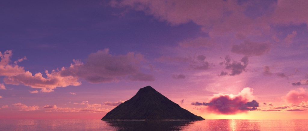
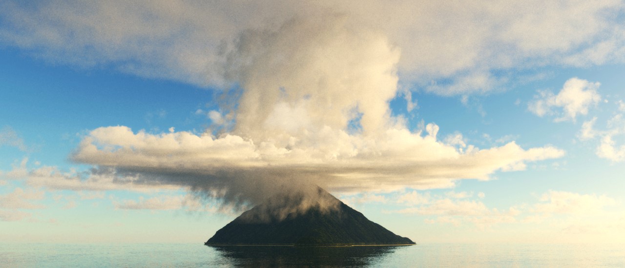
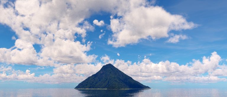
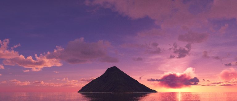
Terragen project rendering a tropical island. As a learning project the idea is to render a island of a extinct carribean vulcano with its typical vegetation, a greenish-blue water and a white, sandy beach. The island will be rendered at three different weather conditions: Advancing tropical storm, Sunny weather at noon and a sunset rendering with sparse clouds.
As the island model geo-referenced data of Chagulak Island is used. It is one OF the Aleutian Islands, a chain of nearly 70 volcanic islands, most belonging to the U.S. state of Alaska. Chagulak Island has a diameter of approx. 4 km and a height of 1142 m.

The initial terrain data is imported as a GeoTIFF image downloaded from the USGS National Map Viewer (https://apps.nationalmap.gov) with a resolution of 1/3 arc seconds, which is equivalent to 10 meters per pixel. It’s necessary to Replace NODATA values (0) after adding the terrain to the scene with Add Terrain > Heightfield (Load DEM) to avoid terrain artefacts. Terragen’s Default Fractal terrain is disabled to ensure a possible water level to and beyond the horizon. The ocean is created by Water | Add Water Object > Lake with a water level at 1 meter height to prevent z-fighting with the terrain polygons.

To simulate the typical erosion based structures of a tropical vulcano island Terragen’s Heightfield erode v3-node is used. The following image shows a comparison of the imported (left) and the final eroded (right) terrain.

Prior to the basic coloring a Painted Shader using a brush with a large falloff parameter of 20 and more is applied as a Displacement Shader to lower the ground level of the seafloor. The terrain consist of several color and fractal based areas for the basic shaders. A clay shader with a dark brown color and a dark green shader simulating the undergrowth, for which no imported objects are used. Furthermore, a sand shader with a light beige color up to 3 m above the water level with a 1 m fuzzy zone to blend from beach to the vegetation area and a default water shader with only a slight shift of the original hue value.

The vegetation of the vulcano area consists of six different XFrog models of tropical trees, which are imported as populatable .obj files with textures. As for Xfrog models usual in Terragen the parameter Source Z up has to be deactivated and a scaling by the factor 1/10 is necessary.
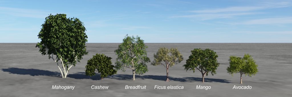
Overall, approx. 3.4 million trees are scattered on an area of 5000 m². Additionally, at the beach region 3100 coconut palm trees are distributed. Furthermore, 150.000 shrubs (Coastal Wattle) are distributed at the region between forest and beach.
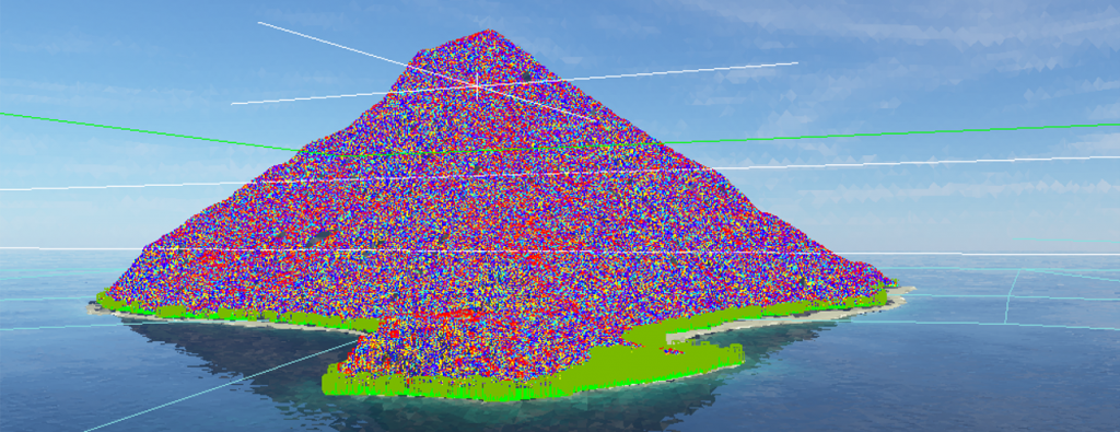
A first test rendering shows the final distribution of the trees. Due to the fact that this island is an extinct vulcano there is no vegetation boundary and trees are populated up to the island’s peak.
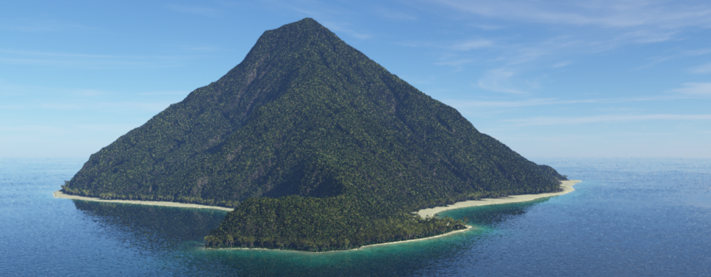
The next steps are fine tuning the scene. First of all, the beach needs some adaptation to the sand surface. The shader is extended by a displacement with a multiplier of 0.065 and a Power fractal shader as displacement function with Tweak Noise Voronoi ridges and a Scale Noise of 15 octaves – here rendered with a single palm tree as size reference.

Next step is to define the shore. Two more surface shaders are added: One dark beige shader simulating wet sand and one with a nearly pure white color simulating the white foam caps of the waves hitting the sand.

Furthermore, the sand is seperated into two diffent surface shaders. While the beach sand has some structure by the displacement shader, the sea sand shader gets some darker spots simulating under water stones by decreasing the Lower Colour Limit Power Fractal from 0.9 to 0.6.

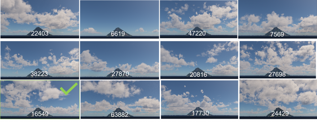
After finishing the terrain, shading and scattering of the vegetation, the next steps are implementing atmospheric effects. The first scene shows a sunny day with Easy Clouds type Altocumulus Castellanus TG 3.9.04 at a coverage of 0.3 and a base altitude of 1600 m and a cloud depth of 4000 m. The center of the cloud object is set to the center of the island. Several values for the random seed are tested to find a suitable cloud configuration.
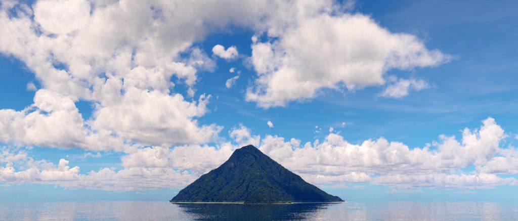
For the final rendering further adaptations are applied: The sunlight heading is set to 270°, the cloud density is increased from default 0.05 to 0.1 to generate dark cloud bottoms, anti-aliasing is set to 6 samples. A Cirrus cloud layer is added for high clouds and post processing after rendering is done with www.pixlr.com adjusting brightness, contrast and highlights.
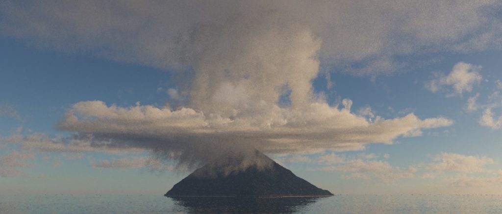
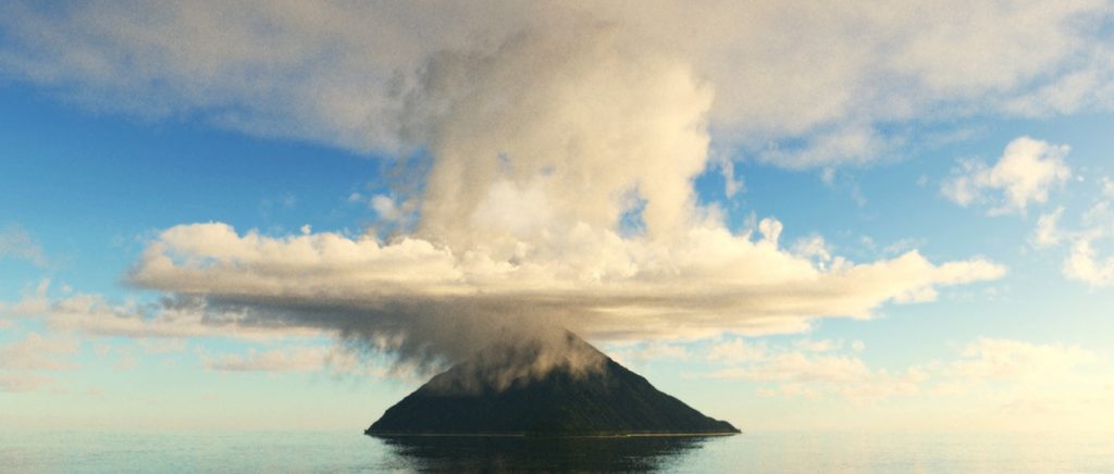
The rendering of the advancing tropical storm scene consists of four different cloud layers. The distant clouds are generated by an Easy Cloud layer: Altocumulus Castellanus TG 3.9.04 with a position far behind the island. The second layer generates the base clouds at the peak of the vulcano. Again an Easy Cloud: Altocumulus Castellanus TG 3.9.04 layer is used restricted to a cylindrical area with a base altitude of 1100 m and a cloud depth of 1400 m. The third layer forms the cloud tower in the center using Easy Cloud: Altocumulus Castellanus TG 3.9.04 with a cylindrical restriction texture to a radius of 7000 m and using a cloud altitude of 2000 m and a depth of 3400 m. The fourth and last layer forms anvil cloud at the top with an altitude of 3900 m, a depth of 600 m and a radius of 10000 m.
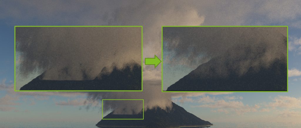
Some tweaks are necessary to thin out the clouds at the base of the cloud system and to hide the lower cloud edge: Base wispiness is set to 0.85 and Base softness to 0. Rendering is done with the Terragen Standard Renderer with Defer atmo/cloud ON, Defer all shading ON. Samples are set from default 3 to nopw 6 to reduce noise (No Customise sampling (1/64 | 0.05)). In Full HD (1920*1080 px²) the rendering took only 109 seconds.
Post production was done again with www.pixlr.com: brightness+35, contrast +42, curve raised at 75%, saturation slighly increased and finally a filter applied: with 50%.
The last scene setup is a sunset rendering with a purple sky and orange shining clouds. The sun is positioned in sight of the camera at a heading of 82° and an elevation of 2° directly above the horizon. A near cloud system (Altostratus Cumulus) set to the center of the island is configured with Sun glow amount increased to 4. A distant Cumulus cloud system is positioned 52 km behind the island so that one larger cloud covers the sun disc.

To realize the desired color configuration the RGB values of the sun, near and distant clouds are adjusted as shown in the following image. The Strength on surface parameter of the Environment Light is increased to 15 to increase the visibility of terrain and vegetation.

No further post poduction adjustments are necessary after rendeirng with the Terragen Standard Renderer using the same rendering settings as for the stormy scene.
